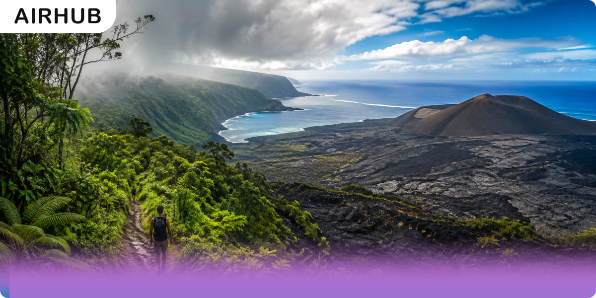
You can be soaked in rainforest drizzle at breakfast and standing on bare lava by lunchtime, and the drive between the two takes about an hour. No other island in Hawaii does that.
The catch is that this variety makes the Big Island genuinely harder to plan than it looks. Several of the best hikes here sit behind a permit, a registration form or a national park gate with an active volcano behind it. Two summit trails shut without much warning when winter weather rolls in. And one of the island’s most famous valleys – still recommended by plenty of guides that haven’t been updated has been closed to hikers since 2022.
So this is a list of eight trails that are actually open, ordered from easiest to hardest, with the logistics that decide whether your plan survives contact with the island. Where a figure needed checking, we checked it.
Why the Big Island Is Unlike Anywhere Else to Hike
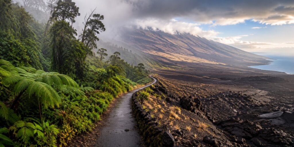
Everyone quotes the same statistic – 8 of the world’s 13 climate zones on one island – and for once the cliché earns its keep. Tropical jungle to alpine desert, inside an hour’s drive.
What that feels like on the ground is closer to whiplash. Ferns overhead and water dripping down your neck, then forty minutes later a lava field steaming in full sun with nothing green in any direction. Very few places on earth hand you both in a single day, and fewer still let you drive between them on a paved road.
Before You Go: Fees, Permits and Closures
Most hiking roundups skip this part. It’s also the part that determines whether your day works out.
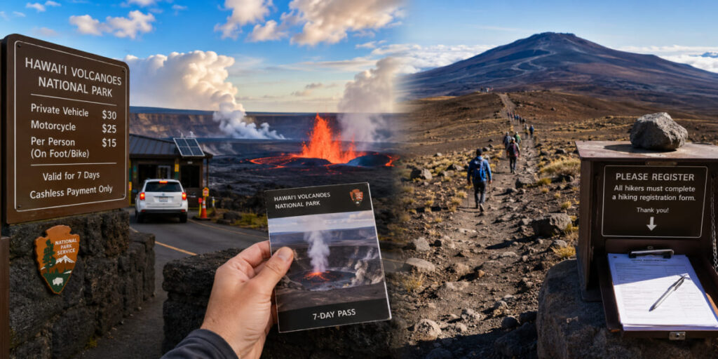
- Hawaiʻi Volcanoes National Park charges to get in – $30 per private vehicle, $25 per motorcycle, or $15 per person arriving on foot or by bike, with the pass valid for seven days. The entrance station is cashless, so bring a card, not bills. That fee covers both Kīlauea Iki and the Mauna Loa trailhead.
- Kīlauea is erupting right now, in episodes. Since December 2024 the volcano has been throwing short, intense fountaining episodes – hours rather than days, separated by pauses of a week or two. Here’s the part that surprises people: the park doesn’t close during summit eruptions. The overwhelming majority of it stays open, Kīlauea Iki included, though individual overlooks near the crater can shut temporarily while fountaining is active. Check the USGS Hawaiian Volcano Observatory and the park’s conditions page on the morning you go, not the week before.
- Take vog seriously. Light or southerly winds drift volcanic gas across the summit area, and at high concentrations it causes real respiratory distress rather than mild discomfort. When air quality is poor, hike somewhere else on the island that day. There’s plenty of islands.
- The Kīlauea Visitor Center is shut for a major renovation running until late 2026. Ranger services, the passport stamp and the bookstore have relocated to a temporary Welcome Center at Kīlauea Military Camp.
- Mauna Kea plays by its own rules. You must stay on designated trails – the Humuʻula Trail among them – and complete a registration form, either handed to a ranger or dropped in the box at the Visitor Information Station, then sign out when you’re done. There’s a cultural dimension too: Mauna Kea is sacred, and a great many visitors deliberately stop at the VIS rather than continuing to the true summit. That’s a considered decision, not an abandoned hike. Current requirements live on the Center for Maunakea Stewardship site.
- Winter closes both summits. Kona lows bring snow, black ice and whiteouts to Mauna Kea and Mauna Loa, and when they do, county and state agencies close the access roads at lower checkpoints. The warning window can be very short.
- Overnighting on Mauna Loa needs a wilderness permit from the park visitor center.
The Eight Hikes at a Glance
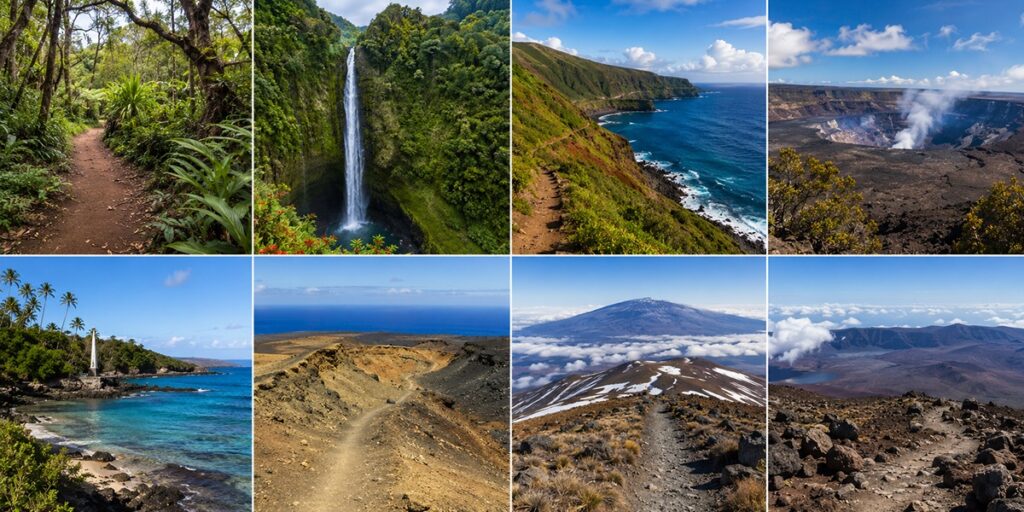
| Trail | Distance | Difficulty | Region | Notes |
|---|---|---|---|---|
| Kaulana Manu Nature Trail | 0.6 mi loop | Easy | Saddle Road | Free; native forest and birds |
| ʻAkaka Falls Trail | ~0.5 mi loop | Easy | Hilo side | State park fee; paved |
| Pololū Valley | 1.2 mi round trip | Moderate (short, steep) | North Kohala | Free; no swimming |
| Kīlauea Iki + Crater Rim Loop | 3.2 mi loop (verify route) | Moderate | Volcanoes NP | Park fee; check eruption status |
| Captain Cook Monument Trail | ~3.8–4 mi round trip | Hard (on the return) | South Kona | Free; snorkelling at the bottom |
| Papakōlea Green Sand Beach | 5.6 mi round trip | Moderate (exposed) | Kaʻū, near South Point | Free; no shade |
| Mauna Kea (Humuʻula Trail) | 13.4 mi round trip | Hard | Saddle Road | High altitude; check access conditions |
| Mauna Loa Summit Trail | 12.8 mi one way | Hard | Volcanoes NP | Park fee; no water, no shelter |
The Trails, Easiest to Hardest
1. Kaulana Manu Nature Trail
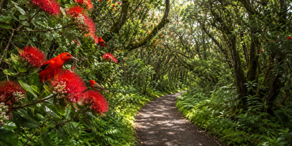
A 0.6-mile loop off Saddle Road, roughly midway between Hilo and Kona, and the easiest genuinely special walk on this list. It was known as Kīpuka 21 until fairly recently, and it threads through pristine native Hawaiian forest -the sort of thing that costs you a hard morning’s climb on Oʻahu and here sits a short stroll from the highway.
The move is to find an ʻŌhiʻa tree in heavy flowers and simply stand near it for a while. That’s where the ʻIʻiwi and ʻApapane come, two native honeycreepers that exist nowhere else on earth. Bring patience rather than boots. It’s also among the best family walks on the island, and nobody has to be persuaded up a hill.
2. ʻAkaka Falls Trail
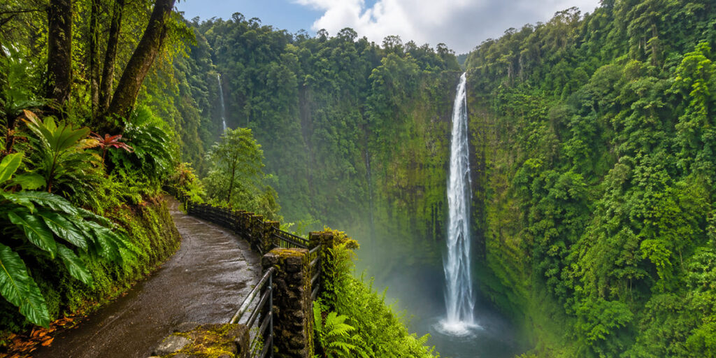
A short paved loop through dense rainforest on the Hilo side, ending at a 442-foot waterfall pouring into a green gorge. The effort-to-reward ratio here is close to absurd, which is exactly why it’s the right call with kids or on the afternoon of a long travel day.
The loop also passes a viewpoint toward Kahuna Falls, though vegetation has steadily swallowed that view over recent years -don’t build the visit around it. The main overlook is the reason to come, and you’ll reach it without breaking a sweat.
3. Pololū Valley
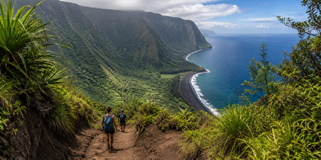
The road simply ends in North Kohala, and what’s waiting is one of the most photographed views in Hawaii: black-sand beach below, green cliffs stacking away into sea haze. Getting down there is short -around 1.2 miles round trip on a roughly 450-foot descent -but steep, and frequently slick with mud.
Wear real shoes. Flip-flops put people in the emergency room on this trail every year, and it’s the climb back out that earns the “moderate” rating rather than anything on the way down. The beach at the bottom is spectacular and the water will kill you: strong currents, no lifeguard, no swimming. Look, photograph, don’t wade.
4. Kīlauea Iki and Crater Rim Loop
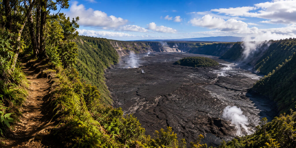
If you only have time for one hike in Hawaiʻi Volcanoes National Park, this is the one. A 3.2-mile loop that begins in rainforest on the crater rim, drops several hundred feet to the crater floor, then walks you directly across a solidified lava lake left behind by the 1959 eruption. Steam still leaks up through cracks in the surface while you’re standing on it.
The contrast is the entire experience -birdsong and tree ferns on the rim, then a black cracked plain with fog curling off the walls, and the transition between them takes about twenty minutes. Bring a layer, because the crater floor runs colder and windier than the parking area ever suggests. Park entrance fee applies, and it’s worth a glance at eruption conditions that morning.
5. Captain Cook Monument Trail
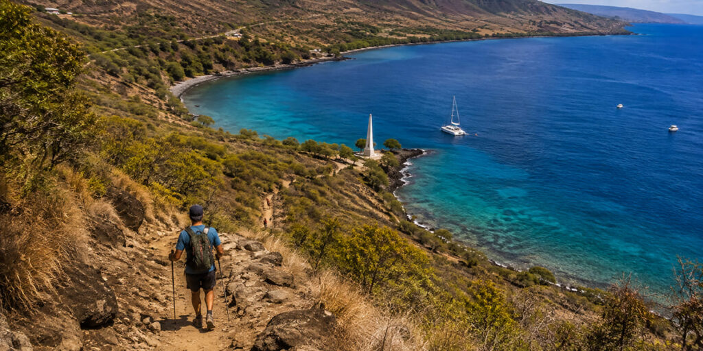
Officially the Kaʻawaloa Trail, this one drops out of South Kona coffee country down to Kealakekua Bay, finishing at the white obelisk marking where Captain Cook was killed in 1779. Roughly four miles round trip, about 1,200 feet of elevation.
Now the honest bit, because distance alone badly undersells this trail. The descent is a pleasant morning. The ascent, in full afternoon sun, with no shade and 1,200 feet to regain, is what people actually remember -and it’s why this hike catches out fit walkers who read the mileage and assumed it was easy. Start early, carry more water than seems reasonable, and pace the return deliberately. The snorkelling at the bottom is genuinely world-class, so bring a mask if you can stand carrying it.
6. Papakōlea Green Sand Beach
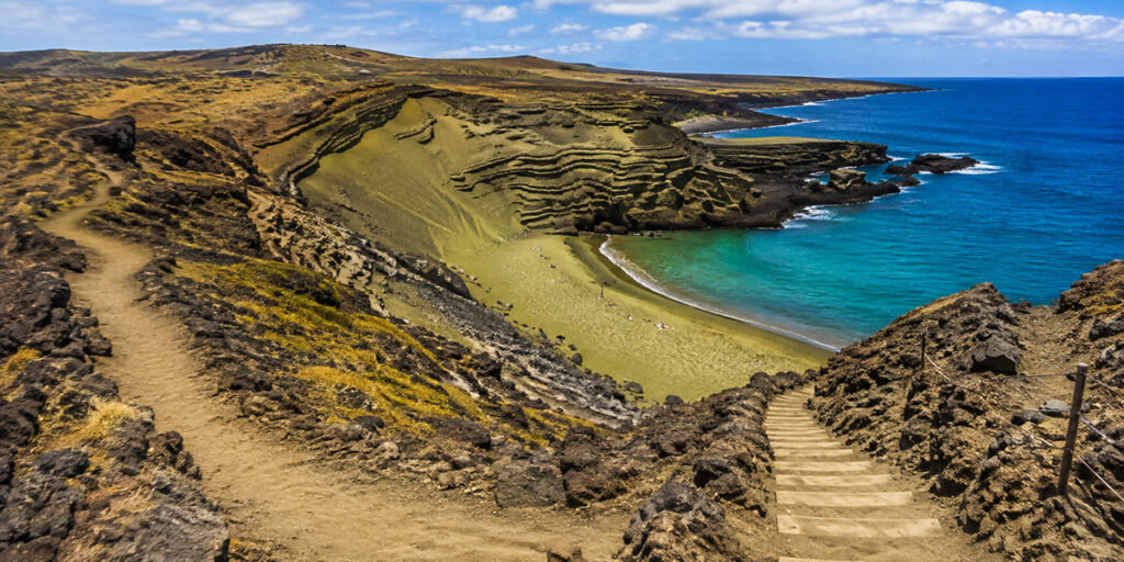
One of a tiny handful of green-sand beaches on the planet, coloured by olivine crystals weathering out of the cinder cone that surrounds it. The walk is around 5.6 miles round trip and almost entirely flat, ending in a scramble down carved steps into a small bowl-shaped bay.
A location correction worth making loudly, because a lot of guides get this wrong: Papakōlea is in the Kaʻū district near South Point (Ka Lae), the southernmost point in the United States. That’s a one-and-a-half to two-hour drive from Kona, not a quick errand from town. Budget the whole day for it.
Difficulty here has nothing to do with terrain and everything to do with exposure. There is no shade at any point, and the sun is merciless. Water and an early start are the entire strategy. Locals run paid 4WD rides along the same track from the trailhead, which is a perfectly sensible option in real heat -though the walk is free, and the coastline deserves to be seen at walking pace.
7. Mauna Kea Summit via the Humuʻula Trail
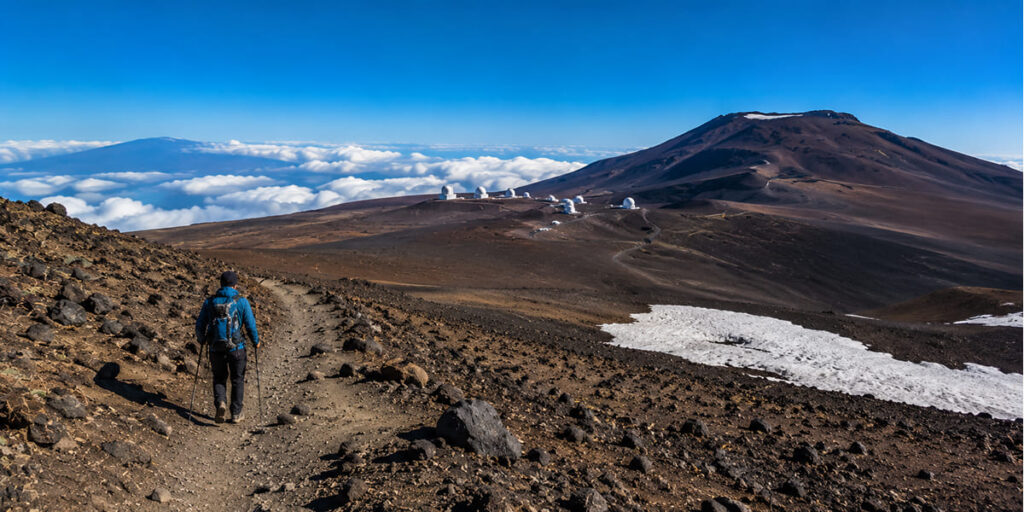
The serious one. Around 13.4 miles round trip, beginning at the Visitor Information Station at roughly 9,200 feet and climbing close to 5,000 more to a summit just under 13,800 -the highest point in Hawaii, and measured from the seafloor, the tallest mountain on earth.
None of the difficulty is technical. All of it is altitude, cold and exposure, and those three take down far fitter people than the terrain ever would. Acclimatise at the VIS for at least half an hour before you set off, and turn around without negotiating with yourself if a headache or nausea appears. Underfoot it’s loose volcanic scree essentially the whole way, which makes the descent harder on the knees than the climb is on the lungs.
Practicalities: complete the registration form, stay on the designated trail, sign out at the end. Winter weather closes the mountain regularly. And it’s worth repeating that Mauna Kea is a sacred site -a lot of hikers walk the VIS area and the Lake Waiau trails and stop there by choice, which is its own kind of respect.
8. Mauna Loa Summit Trail
The hardest thing on this page by a distance. A 12.8-mile route up the largest active volcano on earth, starting above 11,000 feet and gaining nearly 2,800 more across lava rock so sharp that some hikers tape their boots together for protection.
No water. No shade. No shelter. Neil Armstrong trained on Mauna Loa’s flats precisely because the ground resembles the moon, which tells you most of what you need to know about the surface you’ll be crossing. Reach the top and you’re looking down into an enormous caldera with the whole island spread beneath you.
Attempt this one only with full gear, offline maps, a weather window you have actually verified rather than hoped for, and an honest read on your own altitude tolerance. Extending it overnight requires a wilderness permit from the park.
Staying Safe on Big Island Trails
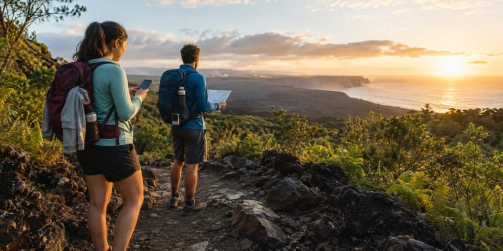
Try not to hike alone -and if you do, tell someone your route and expected finish time before you lose signal, because you will lose signal.
Start early, more so here than in most places. There’s no ambient light on a lava field once the sun goes down, and descending Captain Cook or Pololū in the dark is a genuinely bad idea rather than a mild inconvenience.
Carry more water than the mileage suggests. Papakōlea and Captain Cook are the two that catch people out, and in both cases the culprit is sun rather than difficulty.
Pack a layer for altitude. The summits are properly cold, and even Kīlauea Iki’s crater floor runs cooler than the rim parking lot where you left your fleece.
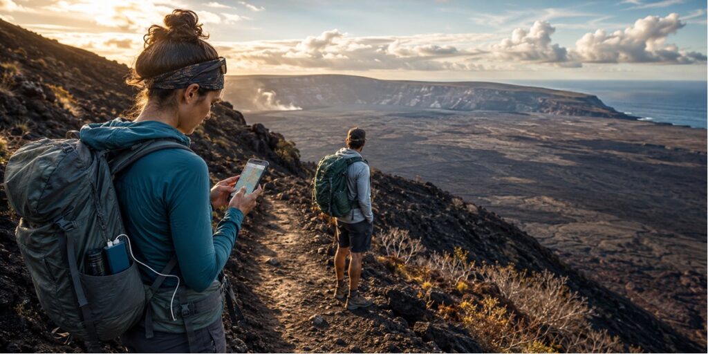
And bring a power bank. Cold and altitude drain phone batteries far faster than normal, and on most of these trails your phone is the map.
Staying Connected and Where You Won’t Be
Let’s be straight about this, since plenty of travel content isn’t.
On the hardest hikes here you will have no signal whatsoever. There is no cell coverage on the Mauna Loa summit route, across most of Mauna Kea’s Humuʻula Trail, or through much of the Volcanoes backcountry -and that holds on every US network, with every carrier, and with any eSIM. No data plan changes physics. Saddle Road and long stretches inside the national park drop out well before you reach a trailhead.
Which means the honest priority order for these trails looks like this:
- Download offline maps before you leave Wi-Fi -the whole route, not just the trailhead.
- Find out whether your phone has satellite SOS. Recent iPhones and several flagship Androids can send an emergency message via satellite with no cellular signal at all. On Mauna Loa, that’s the feature that genuinely matters.
- Tell someone your plan -still the most reliable safety device ever invented, and it weighs nothing.
- Carry a power bank, because none of the above survives a dead battery.
Do you actually need a travel eSIM in Hawaii?
Worth answering plainly, given we sell them.
Travelling from within the United States? No. Hawaii is a US state. Your existing plan works exactly as it does at home, and you should keep your money for the park fee.
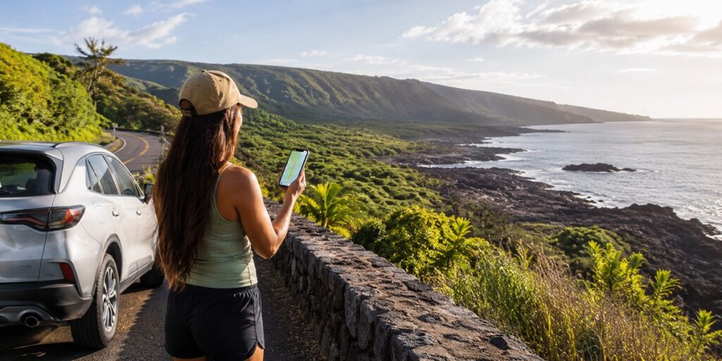
Travelling internationally? Yes -and what you want is a USA plan. There’s no such thing as a separate Hawaiian network. An eSIM Hawaii plan is a US eSIM connecting to the same national carriers every other phone on the island uses. Where it earns its cost is Hilo, Kona, Waimea, the highways and most trailhead approaches -the navigation, the rental car, the restaurant booking, the drive back in the dark. Not the summit.
Browse esim data plans by destination, and check your handset against our eSIM compatible devices list before buying anything. Our travel eSIM for the USA guide goes deeper on which network you actually connect to.
FAQs
1. What is the most popular hike on the Big Island?
The Kīlauea Iki and Crater Rim Loop in Hawaiʻi Volcanoes National Park -a 3.2-mile loop that drops into a crater and crosses a solidified lava lake from the 1959 eruption.
2. Are there easy hikes on the Big Island?
Several. ʻAkaka Falls Trail is a short paved loop to a 442-foot waterfall, and Kaulana Manu Nature Trail is an easy 0.6-mile loop through native forest off Saddle Road. Both work for families and beginners.
3. Is Waipiʻo Valley open to hikers?
No. Access to Waipiʻo Valley and its trails has been prohibited since February 2022 under a County Mayor’s Order, because of unsafe geologic conditions along the access road. For comparable valley scenery, Pololū Valley in North Kohala is open.
4. Which Big Island hikes have waterfalls?
ʻAkaka Falls Trail is the most accessible waterfall hike on the island. Check current status before setting out for others, since several waterfall trails have been affected by access closures.
5. Can you hike to a green sand beach on the Big Island?
Yes -Papakōlea, via a 5.6-mile round-trip walk in the Kaʻū district near South Point. Flat, but entirely unshaded, so carry water and start early.
6. Do I need a permit to hike Mauna Kea?
You need to complete a registration form, stay on designated trails such as the Humuʻula Trail, and sign out afterwards. Check the Center for Maunakea Stewardship for current requirements before you travel.
7. How much does Hawaiʻi Volcanoes National Park cost?
$30 per private vehicle, $25 per motorcycle, or $15 per person on foot or by bicycle. Passes last seven days and the entrance station is cashless.
8. Is it safe to hike near Kīlauea while it’s erupting?
The park stays open during summit eruptions and most trails remain accessible, though specific overlooks close temporarily during active fountaining. Check USGS and the park’s conditions page the morning you go, and take vog warnings seriously.
9. Is there cell service on Big Island hiking trails?
Near towns and many trailheads, yes. On the Mauna Loa route, most of the Humuʻula Trail and much of the Volcanoes backcountry, none -on any network. Download offline maps first.
10. When do the summit trails close?
Mauna Kea and Mauna Loa access roads close in winter storm conditions, sometimes at very short notice, for snow, ice and high winds. Check road status before you drive up.
Before You Head Out
Check what’s open. Pay the park fee. Register for Mauna Kea. Download your maps while you still have signal. Carry more water than the distance suggests.
Flying in from outside the US? Sort your data before you land Buy eSIM for the United States and it’ll be working by the time you reach the rental car counter.
Leave a Reply